
ಚಿತ್ರ:Canada British Columbia (no subdivisions) location map.svg

Size of this PNG preview of this SVG file: ೭೪೦ × ೬೦೦ ಪಿಕ್ಸೆಲ್ಗಳು. ಇತರ ರೆಸಲ್ಯೂಶನ್ಗಳು: ೨೯೬ × ೨೪೦ ಪಿಕ್ಸೆಲ್ಗಳು | ೫೯೩ × ೪೮೦ ಪಿಕ್ಸೆಲ್ಗಳು | ೯೪೮ × ೭೬೮ ಪಿಕ್ಸೆಲ್ಗಳು | ೧,೨೬೪ × ೧,೦೨೪ ಪಿಕ್ಸೆಲ್ಗಳು | ೨,೫೨೮ × ೨,೦೪೮ ಪಿಕ್ಸೆಲ್ಗಳು | ೨,೪೧೯ × ೧,೯೬೦ ಪಿಕ್ಸೆಲ್ಗಳು.
ಮೂಲ ಕಡತ (SVG ಫೈಲು, ಸುಮಾರಾಗಿ ೨,೪೧೯ × ೧,೯೬೦ ಚಿತ್ರಬಿಂದುಗಳು, ಫೈಲಿನ ಗಾತ್ರ: ೧.೨೬ MB)
ಈ ಫೈಲು ವಿಕಿಮೀಡಿಯ ಕಾಮನ್ಸ್ನಲ್ಲಿ ಇರುವುದು. ಅಲ್ಲಿನ ವಿವರಣೆ ಪುಟವನ್ನೇ ಕೆಳಗೆ ತೋರಿಸಲಾಗಿದೆ. ಕಾಮನ್ಸ್ ಕೃತಿಸ್ವಾಮ್ಯತೆಯಿಂದ ಮುಕ್ತ ಫೈಲುಗಳ ಒಂದು ಆಗರ. ಅಲ್ಲಿ ನೀವೂ ಸಹಕರಿಸಬಹುದು. |
_location_map.svg)
W3C-validity not checked.
ಸಾರಾಂಶ
| ವಿವರ |
Quadratische Plattkarte, N-S-Streckung 170 %. Geographische Begrenzung der Karte:
Equirectangular projection, N/S stretching 170 %. Geographic limits of the map:
|
| ದಿನಾಂಕ | |
| ಆಕರ |
ಸ್ವಂತ ಕೆಲಸ, using
|
| ಕರ್ತೃ | NordNordWest |
| ಅನುಮತಿ (ಈ ಕಡತವನ್ನು ಮರುಬಳಕೆ ಮಾಡಲಾಗುತ್ತಿದೆ) |
I, the copyright holder of this work, hereby publish it under the following license: ಈ ಕಡತ ಕ್ರಿಯೇಟಿವ್ ಕಾಮನ್ಸ್ Attribution
-Share Alike 3.0 Unported ಪರವಾನಗಿ ಹೊಂದಿದೆ.
|
| ಇತರೆ ಆವೃತ್ತಿಗಳು | file:Canada British Columbia location map.svg Regular version with district boundaries |

|
This map has been made or improved in the German Kartenwerkstatt (Map Lab). You can propose maps to improve as well.
|
ಕಡತದ ಇತಿಹಾಸ
ದಿನ/ಕಾಲ ಒತ್ತಿದರೆ ಆ ಸಮಯದಲ್ಲಿ ಈ ಕಡತದ ವಸ್ತುಸ್ಥಿತಿ ತೋರುತ್ತದೆ.
| ದಿನ/ಕಾಲ | ಕಿರುನೋಟ | ಆಯಾಮಗಳು | ಬಳಕೆದಾರ | ಟಿಪ್ಪಣಿ | |
|---|---|---|---|---|---|
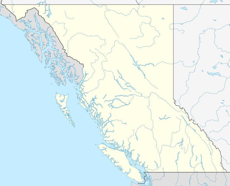
| ಪ್ರಸಕ್ತ | ೨೦:೨೬, ೨೭ ಆಗಸ್ಟ್ ೨೦೦೯ | | ೨,೪೧೯ × ೧,೯೬೦ (೧.೨೬ MB) | NordNordWest | {{int:filedesc}} {{Information |Description= {{de|Positionskarte von British Columbia, Kanada}} Quadratische Plattkarte, N-S-Streckung 170 %. Geographische Begrenzung der Karte: * N: 60.3° N * S: 48.1° N * W: 139. |
ಕಡತ ಬಳಕೆ
ಈ ಕೆಳಗಿನ 2 ಪುಟಗಳು ಈ ಚಿತ್ರಕ್ಕೆ ಸಂಪರ್ಕ ಹೊಂದಿವೆ:
ಜಾಗತಿಕ ಕಡತ ಉಪಯೋಗ
ಈ ಕಡತವನ್ನು ಕೆಳಗಿನ ಬೇರೆ ವಿಕಿಗಳೂ ಉಪಯೋಗಿಸುತ್ತಿವೆ:
- ar.wikipedia.org ಮೇಲೆ ಬಳಕೆ
- ast.wikipedia.org ಮೇಲೆ ಬಳಕೆ
- de.wikipedia.org ಮೇಲೆ ಬಳಕೆ
- en.wikipedia.org ಮೇಲೆ ಬಳಕೆ
- Garibaldi Provincial Park
- Tatshenshini-Alsek Provincial Park
- Kokanee Glacier Provincial Park
- Whiteswan Lake Provincial Park
- Fort Langley
- Lulu Island
- Grand Canyon of the Fraser
- Atlin/Áa Tlein Téix'i Provincial Park
- Caligata Lake Provincial Park
- Cathedral Provincial Park and Protected Area
- Yard Creek Provincial Park
- Yahk Provincial Park
- E. C. Manning Provincial Park
- Entiako Provincial Park
- Englishman River Falls Provincial Park
- Itcha Ilgachuz Provincial Park
- Kikomun Creek Provincial Park
- Klewnuggit Inlet Marine Provincial Park
- Kokanee Creek Provincial Park
- Lowe Inlet Marine Provincial Park
- Mansons Landing Provincial Park
- Marl Creek Provincial Park
- Martha Creek Provincial Park
- Ningunsaw Provincial Park
- Nitinat River Provincial Park
- Northern Rocky Mountains Provincial Park
- Whiskers Point Provincial Park
- White Lake Provincial Park
- White Pelican Provincial Park
- White Ridge Provincial Park
- White River Provincial Park
- Windermere Lake Provincial Park
- Wire Cache Provincial Park
- Wistaria Provincial Park
- Woss Lake Provincial Park
- Pink Mountain Provincial Park
- Rearguard Falls Provincial Park
- Strathcona Provincial Park
- Strathcona-Westmin Provincial Park
- Tweedsmuir North Provincial Park and Protected Area
- Tweedsmuir South Provincial Park
- Moresby Island
- Giscome Portage
- Machmell River Cone
- Cascade City
- Trial Islands (British Columbia)
- Wales Island (British Columbia)
ಈ ಫೈಲ್ನ ಹೆಚ್ಚು ಜಾಗತಿಕ ಬಳಕೆಯನ್ನು ವೀಕ್ಷಿಸಿ.
_location_map.svg)
_location_map.svg)