
ಚಿತ್ರ:Benelux location map.svg

ಮೂಲ ಕಡತ (SVG ಫೈಲು, ಸುಮಾರಾಗಿ ೯೬೦ × ೧,೩೦೪ ಚಿತ್ರಬಿಂದುಗಳು, ಫೈಲಿನ ಗಾತ್ರ: ೧೭೫ KB)
ಈ ಫೈಲು ವಿಕಿಮೀಡಿಯ ಕಾಮನ್ಸ್ನಲ್ಲಿ ಇರುವುದು. ಅಲ್ಲಿನ ವಿವರಣೆ ಪುಟವನ್ನೇ ಕೆಳಗೆ ತೋರಿಸಲಾಗಿದೆ. ಕಾಮನ್ಸ್ ಕೃತಿಸ್ವಾಮ್ಯತೆಯಿಂದ ಮುಕ್ತ ಫೈಲುಗಳ ಒಂದು ಆಗರ. ಅಲ್ಲಿ ನೀವೂ ಸಹಕರಿಸಬಹುದು. |
ಸಾರಾಂಶ
| ವಿವರ |
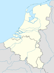
Deutsch: Positionskarte der Benelux-Staaten
Quadratische Plattkarte, N-S-Streckung 160 %. Geographische Begrenzung der Karte:
English: Location map of the Benelux countries
Equirectangular projection, N/S stretching 160 %. Geographic limits of the map:
|
|
| ದಿನಾಂಕ | ||
| ಆಕರ |
ಸ್ವಂತ ಕೆಲಸ, using
|
|
| ಕರ್ತೃ | NordNordWest | |
| ಅನುಮತಿ (ಈ ಕಡತವನ್ನು ಮರುಬಳಕೆ ಮಾಡಲಾಗುತ್ತಿದೆ) |
This file is licensed under the Creative Commons Attribution-Share Alike 3.0 Germany license.
 ಈ ಕಡತ ಕ್ರಿಯೇಟಿವ್ ಕಾಮನ್ಸ್ Attribution
-Share Alike 3.0 Unported ಪರವಾನಗಿ ಹೊಂದಿದೆ.
|


|
This map has been made or improved in the German Kartenwerkstatt (Map Lab). You can propose maps to improve as well.
|
ಕಡತದ ಇತಿಹಾಸ
ದಿನ/ಕಾಲ ಒತ್ತಿದರೆ ಆ ಸಮಯದಲ್ಲಿ ಈ ಕಡತದ ವಸ್ತುಸ್ಥಿತಿ ತೋರುತ್ತದೆ.
| ದಿನ/ಕಾಲ | ಕಿರುನೋಟ | ಆಯಾಮಗಳು | ಬಳಕೆದಾರ | ಟಿಪ್ಪಣಿ | |
|---|---|---|---|---|---|
| ಪ್ರಸಕ್ತ | ೦೦:೦೪, ೧೮ ಫೆಬ್ರವರಿ ೨೦೧೧ | | ೯೬೦ × ೧,೩೦೪ (೧೭೫ KB) | NordNordWest | == {{int:filedesc}} == {{Information |Description= {{de|Positionskarte der Benelux-Staaten}} Quadratische Plattkarte, N-S-Streckung 160 %. Geographische Begrenzung der Karte: * N: 53.7° N * S: 49.2° N * W: 2.2° O * O: 7.5° O {{en|Locat |
ಕಡತ ಬಳಕೆ
ಈ ಕೆಳಗಿನ ಪುಟವು ಈ ಚಿತ್ರಕ್ಕೆ ಸಂಪರ್ಕ ಹೊಂದಿದೆ:
ಜಾಗತಿಕ ಕಡತ ಉಪಯೋಗ
ಈ ಕಡತವನ್ನು ಕೆಳಗಿನ ಬೇರೆ ವಿಕಿಗಳೂ ಉಪಯೋಗಿಸುತ್ತಿವೆ:
- ar.wikipedia.org ಮೇಲೆ ಬಳಕೆ
- ba.wikipedia.org ಮೇಲೆ ಬಳಕೆ
- bn.wikipedia.org ಮೇಲೆ ಬಳಕೆ
- bs.wikipedia.org ಮೇಲೆ ಬಳಕೆ
- ceb.wikipedia.org ಮೇಲೆ ಬಳಕೆ
- ckb.wikipedia.org ಮೇಲೆ ಬಳಕೆ
- da.wikipedia.org ಮೇಲೆ ಬಳಕೆ
- de.wikipedia.org ಮೇಲೆ ಬಳಕೆ
- Intercity-Express
- Liste der Nationalparks im Königreich der Niederlande
- Benutzer:Spischot/Sketchpad 3
- Werder Bremen/Namen und Zahlen
- Wikipedia:Kartenwerkstatt/Positionskarten/Europa
- Freie-Partie-Europameisterschaft
- Coupe d’Europe
- Superprestige Cyclocross 2010/11
- Vorlage:Positionskarte Benelux
- Wikipedia:Kartenwerkstatt/Archiv/2011-02
- National League (Belgien)
- Benutzer:Rafael Zink/Vorlagen/Karten
- Crystal Kelly Cup
- Dreiband-Europameisterschaft der Junioren
- Liste benannter IC/ICE-Fahrzeuge
- Benutzer:Gps-for-five/Spielwiese/Vorlage:Suche Poskarte
- Benutzer:Gps-for-five/Spielwiese/Vorlage:Suche Poskarte/Doku
- Vorlage:Suche Positionskarte
- Vorlage:Suche Positionskarte/Doku
- Benutzer:HugoVert/Werders Europapokalgegner
- Grenzpark Kalmthoutse Heide
- Drei-Nationen-Turnier (Frauenfußball, 2021)
- Zweikampf-Europameisterschaft der Junioren
- Benutzer:Wizzo818/Eintracht Frankfurt/Europapokalstatistik
- en.wikipedia.org ಮೇಲೆ ಬಳಕೆ
- Benelux
- Trappist beer
- 't Haantje, Drenthe
- Putte, Netherlands
- 't Woudt
- North Sea Cup
- 2008–09 Euro Hockey League
- Belgium–Netherlands 2018 FIFA World Cup bid
- 2009–10 Euro Hockey League
- Mount Saint Peter
- Module:Location map/data/Benelux/doc
- 2010–11 Euro Hockey League
- 2012–13 BeNe League
- 2011–12 Euro Hockey League
- Nederlandse Rugby League Bond Championship
ಈ ಫೈಲ್ನ ಹೆಚ್ಚು ಜಾಗತಿಕ ಬಳಕೆಯನ್ನು ವೀಕ್ಷಿಸಿ.