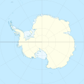
ಚಿತ್ರ:Antarctica location map.svg

Size of this PNG preview of this SVG file: ೬೦೦ × ೬೦೦ ಪಿಕ್ಸೆಲ್ಗಳು. ಇತರ ರೆಸಲ್ಯೂಶನ್ಗಳು: ೨೪೦ × ೨೪೦ ಪಿಕ್ಸೆಲ್ಗಳು | ೪೮೦ × ೪೮೦ ಪಿಕ್ಸೆಲ್ಗಳು | ೭೬೮ × ೭೬೮ ಪಿಕ್ಸೆಲ್ಗಳು | ೧,೦೨೪ × ೧,೦೨೪ ಪಿಕ್ಸೆಲ್ಗಳು | ೨,೦೪೮ × ೨,೦೪೮ ಪಿಕ್ಸೆಲ್ಗಳು | ೧,೨೦೦ × ೧,೨೦೦ ಪಿಕ್ಸೆಲ್ಗಳು.
ಮೂಲ ಕಡತ (SVG ಫೈಲು, ಸುಮಾರಾಗಿ ೧,೨೦೦ × ೧,೨೦೦ ಚಿತ್ರಬಿಂದುಗಳು, ಫೈಲಿನ ಗಾತ್ರ: ೨೩೩ KB)
ಕಡತದ ಇತಿಹಾಸ
ದಿನ/ಕಾಲ ಒತ್ತಿದರೆ ಆ ಸಮಯದಲ್ಲಿ ಈ ಕಡತದ ವಸ್ತುಸ್ಥಿತಿ ತೋರುತ್ತದೆ.
| ದಿನ/ಕಾಲ | ಕಿರುನೋಟ | ಆಯಾಮಗಳು | ಬಳಕೆದಾರ | ಟಿಪ್ಪಣಿ | |
|---|---|---|---|---|---|
| ಪ್ರಸಕ್ತ | ೦೬:೦೧, ೯ ಏಪ್ರಿಲ್ ೨೦೧೫ |  | ೧,೨೦೦ × ೧,೨೦೦ (೨೩೩ KB) | Ravenpuff | Minor changes |
| ೨೧:೪೬, ೩ ಮೇ ೨೦೧೧ |  | ೧,೨೦೦ × ೧,೨೦೦ (೨೩೨ KB) | Alexrk2 | - | |
| ೨೧:೪೪, ೩ ಮೇ ೨೦೧೧ |  | ೧,೨೦೦ × ೧,೨೦೦ (೨೩೨ KB) | Alexrk2 | + Peter I. Insel | |
| ೧೯:೫೪, ೨೧ ಫೆಬ್ರವರಿ ೨೦೧೦ |  | ೧,೨೦೦ × ೧,೨೦೦ (೨೧೭ KB) | Alexrk2 | == Summary == {{Information |Description= {{de|Positionskarte Antarktis, Mittabstandstreue Azimutalprojektion}} {{en|Location map Antarctica, Azimuthal equidistant projection}} * Longitude of central meridian: 0° * La |
ಕಡತ ಬಳಕೆ
ಈ ಕೆಳಗಿನ 2 ಪುಟಗಳು ಈ ಚಿತ್ರಕ್ಕೆ ಸಂಪರ್ಕ ಹೊಂದಿವೆ:
ಜಾಗತಿಕ ಕಡತ ಉಪಯೋಗ
ಈ ಕಡತವನ್ನು ಕೆಳಗಿನ ಬೇರೆ ವಿಕಿಗಳೂ ಉಪಯೋಗಿಸುತ್ತಿವೆ:
- af.wikipedia.org ಮೇಲೆ ಬಳಕೆ
- ar.wikipedia.org ಮೇಲೆ ಬಳಕೆ
- arz.wikipedia.org ಮೇಲೆ ಬಳಕೆ
- ast.wikipedia.org ಮೇಲೆ ಬಳಕೆ
- Polu Sur
- Islla Esperanto
- Islles Shetland del Sur
- Base Vostok
- Base Antártica Juan Carlos I
- Base Concordia
- Islla White (L'Antártida)
- Monte Erebus
- Mar d'Amundsen
- Mar de Bellingshausen
- Mar de Ross
- Mar de Weddell
- Macizu Vinson
- Montes Tresantárticos
- Llagu Vostok
- Península Antártica
- Islla Berkner
- Barrera de xelu Filchner-Ronne
- Tierra de Coats
- Indlandsis de L'Antártida
- L'Antártida Occidental
- Barrera de xelu Larsen
- Península Trinidá
- Capa de xelu de L'Antártida occidental
- Islla Pedru I
- Tierra de Marie Byrd
- Módulu:Mapa de llocalización/datos/Antártida
- Módulu:Mapa de llocalización/datos/Antártida/usu
- Aeródromu Teniente Rodolfo Marsh Martin
- Aeródromu Wilkins
- Aeródromu de Molodiózhnaya
- Aeródromu de Punta Rothera
- Aeródromu de Troll
- Base Casey
- Base Davis
- Base Edgeworth David
- Base Fossil Bluff
- Base Halley
- Base Mario Zucchelli
- Base Mawson
- Base N
- Base Plateau
ಈ ಫೈಲ್ನ ಹೆಚ್ಚು ಜಾಗತಿಕ ಬಳಕೆಯನ್ನು ವೀಕ್ಷಿಸಿ.


