
ಚಿತ್ರ:Wfm nellis range redactions.jpg
ಈ ಮುನ್ನೋಟ ಗಾತ್ರ:೮೦೦ × ೫೯೩ ಪಿಕ್ಸೆಲ್ಗಳು. ಇತರ ರೆಸಲ್ಯೂಶನ್ಗಳು: ೩೨೦ × ೨೩೭ ಪಿಕ್ಸೆಲ್ಗಳು | ೬೪೦ × ೪೭೪ ಪಿಕ್ಸೆಲ್ಗಳು | ೧,೦೨೪ × ೭೫೮ ಪಿಕ್ಸೆಲ್ಗಳು | ೧,೨೮೦ × ೯೪೮ ಪಿಕ್ಸೆಲ್ಗಳು.
ಮೂಲ ಕಡತ (೧,೨೮೦ × ೯೪೮ ಚಿತ್ರಬಿಂದು, ಫೈಲಿನ ಗಾತ್ರ: ೧೨೮ KB, MIME ಪ್ರಕಾರ: image/jpeg)
ಈ ಫೈಲು ವಿಕಿಮೀಡಿಯ ಕಾಮನ್ಸ್ನಲ್ಲಿ ಇರುವುದು. ಅಲ್ಲಿನ ವಿವರಣೆ ಪುಟವನ್ನೇ ಕೆಳಗೆ ತೋರಿಸಲಾಗಿದೆ. ಕಾಮನ್ಸ್ ಕೃತಿಸ್ವಾಮ್ಯತೆಯಿಂದ ಮುಕ್ತ ಫೈಲುಗಳ ಒಂದು ಆಗರ. ಅಲ್ಲಿ ನೀವೂ ಸಹಕರಿಸಬಹುದು. |
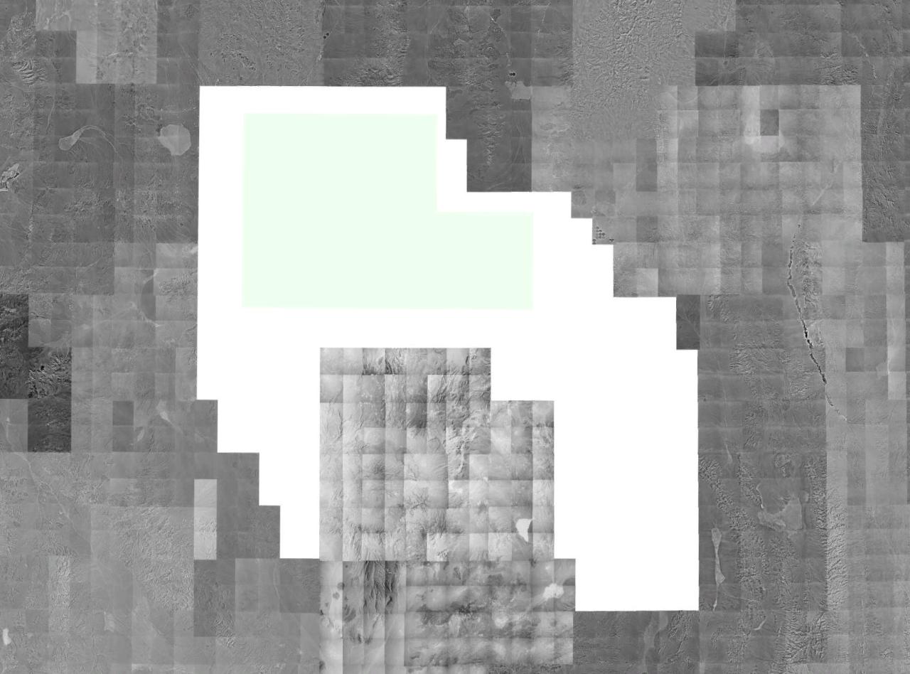
English: A montage image of southern Nevada, showing available USGS/NRO monochrome digital orthographic photography. Quads covering the Nellis Air Force Range (NAFR) are redacted from the photostream at source (and show up in this image in blank white). The Nevada Test Site (surrounded by the NAFR on three sides) is not redacted.
The verdant strip, (north-south) in the northeast is en:Pahranagat Valley.
The verdant strip, (north-south) in the northeast is en:Pahranagat Valley.
Source: USGS/NRO satellite photography, collected via NASA World Wind.
This image is in the public domain in the United States because it only contains materials that originally came from the United States Geological Survey, an agency of the United States Department of the Interior. For more information, see the official USGS copyright policy.
|
ಕಡತದ ಇತಿಹಾಸ
ದಿನ/ಕಾಲ ಒತ್ತಿದರೆ ಆ ಸಮಯದಲ್ಲಿ ಈ ಕಡತದ ವಸ್ತುಸ್ಥಿತಿ ತೋರುತ್ತದೆ.
| ದಿನ/ಕಾಲ | ಕಿರುನೋಟ | ಆಯಾಮಗಳು | ಬಳಕೆದಾರ | ಟಿಪ್ಪಣಿ | |
|---|---|---|---|---|---|
| ಪ್ರಸಕ್ತ | ೨೦:೧೦, ೨೧ ಜೂನ್ ೨೦೦೬ | | ೧,೨೮೦ × ೯೪೮ (೧೨೮ KB) | Finlay McWalter | A montage image of southern Nevada, showing available USGS/NRO monochrome digital orthographic photography. Quads covering the Nellis Air Force Range (NAFR) are redacted from the photostream at source (and show up in this image in blank white). The Neva |
ಕಡತ ಬಳಕೆ
ಈ ಕೆಳಗಿನ ಪುಟವು ಈ ಚಿತ್ರಕ್ಕೆ ಸಂಪರ್ಕ ಹೊಂದಿದೆ:
ಜಾಗತಿಕ ಕಡತ ಉಪಯೋಗ
ಈ ಕಡತವನ್ನು ಕೆಳಗಿನ ಬೇರೆ ವಿಕಿಗಳೂ ಉಪಯೋಗಿಸುತ್ತಿವೆ:
- ar.wikipedia.org ಮೇಲೆ ಬಳಕೆ
- en.wikipedia.org ಮೇಲೆ ಬಳಕೆ
- hi.wikipedia.org ಮೇಲೆ ಬಳಕೆ
- it.wikipedia.org ಮೇಲೆ ಬಳಕೆ
- ta.wikipedia.org ಮೇಲೆ ಬಳಕೆ