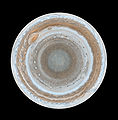
ಚಿತ್ರ:Map of Jupiter.jpg

ಈ ಮುನ್ನೋಟ ಗಾತ್ರ:೫೯೦ × ೫೯೯ ಪಿಕ್ಸೆಲ್ಗಳು. ಇತರ ರೆಸಲ್ಯೂಶನ್ಗಳು: ೨೩೬ × ೨೪೦ ಪಿಕ್ಸೆಲ್ಗಳು | ೪೭೩ × ೪೮೦ ಪಿಕ್ಸೆಲ್ಗಳು | ೭೫೬ × ೭೬೮ ಪಿಕ್ಸೆಲ್ಗಳು | ೧,೦೦೮ × ೧,೦೨೪ ಪಿಕ್ಸೆಲ್ಗಳು | ೨,೨೩೧ × ೨,೨೬೬ ಪಿಕ್ಸೆಲ್ಗಳು.
ಮೂಲ ಕಡತ (೨,೨೩೧ × ೨,೨೬೬ ಚಿತ್ರಬಿಂದು, ಫೈಲಿನ ಗಾತ್ರ: ೪೨೬ KB, MIME ಪ್ರಕಾರ: image/jpeg)
ಕಡತದ ಇತಿಹಾಸ
ದಿನ/ಕಾಲ ಒತ್ತಿದರೆ ಆ ಸಮಯದಲ್ಲಿ ಈ ಕಡತದ ವಸ್ತುಸ್ಥಿತಿ ತೋರುತ್ತದೆ.
| ದಿನ/ಕಾಲ | ಕಿರುನೋಟ | ಆಯಾಮಗಳು | ಬಳಕೆದಾರ | ಟಿಪ್ಪಣಿ | |
|---|---|---|---|---|---|
| ಪ್ರಸಕ್ತ | ೧೬:೨೯, ೧೪ ಫೆಬ್ರವರಿ ೨೦೦೭ |  | ೨,೨೩೧ × ೨,೨೬೬ (೪೨೬ KB) | Helix84 | {{en| :This map of Jupiter is the most detailed global color map of the planet ever produced. The round map is a polar stereographic projection that shows the south pole in the center of the map and the equator at the edge. It was constructed from images |
ಕಡತ ಬಳಕೆ
ಈ ಕೆಳಗಿನ 2 ಪುಟಗಳು ಈ ಚಿತ್ರಕ್ಕೆ ಸಂಪರ್ಕ ಹೊಂದಿವೆ:
ಜಾಗತಿಕ ಕಡತ ಉಪಯೋಗ
ಈ ಕಡತವನ್ನು ಕೆಳಗಿನ ಬೇರೆ ವಿಕಿಗಳೂ ಉಪಯೋಗಿಸುತ್ತಿವೆ:
- af.wikipedia.org ಮೇಲೆ ಬಳಕೆ
- ar.wikipedia.org ಮೇಲೆ ಬಳಕೆ
- bn.wikipedia.org ಮೇಲೆ ಬಳಕೆ
- ca.wikipedia.org ಮೇಲೆ ಬಳಕೆ
- de.wikipedia.org ಮೇಲೆ ಬಳಕೆ
- en.wikipedia.org ಮೇಲೆ ಬಳಕೆ
- Jupiter
- Wikipedia:Featured pictures thumbs/05
- Wikipedia:Featured picture candidates/October-2006
- Wikipedia:Featured picture candidates/Map of Jupiter
- User:Andonic/Successful Featured Picture Nominations
- Wikipedia:Featured picture candidates/January-2007
- Wikipedia:Featured picture candidates/Polar Map of Jupiter
- Wikipedia:Wikipedia Signpost/2007-01-15/Features and admins
- Wikipedia:Wikipedia Signpost/2007-01-15/SPV
- User talk:Andonic/Archive 7
- Wikipedia:WikiProject Astronomy/Recognized content
- Portal:Solar System/Selected article
- Portal:Solar System/Selected picture
- Wikipedia:Picture of the day/May 2007
- Template:POTD/2007-05-10
- User talk:Andonic/Archive 11
- Portal:Solar System/Selected picture/11
- Wikipedia:Featured pictures/Space/Looking out
- Wikipedia:Today's featured article/August 2009
- Wikipedia:Today's featured article/August 25, 2009
- Portal:Solar System/Selected article/21
- Talk:Jupiter/Archive 5
- Atmosphere of Jupiter
- Wikipedia:WikiProject Astronomy/Recognized astronomy content
- Wikipedia:Wikipedia Signpost/Single/2007-01-15
- es.wikipedia.org ಮೇಲೆ ಬಳಕೆ
- eu.wikipedia.org ಮೇಲೆ ಬಳಕೆ
- fr.wikipedia.org ಮೇಲೆ ಬಳಕೆ
- it.wikipedia.org ಮೇಲೆ ಬಳಕೆ
- ja.wikipedia.org ಮೇಲೆ ಬಳಕೆ
- la.wikipedia.org ಮೇಲೆ ಬಳಕೆ
- mk.wikipedia.org ಮೇಲೆ ಬಳಕೆ
- nds.wikipedia.org ಮೇಲೆ ಬಳಕೆ
- no.wikipedia.org ಮೇಲೆ ಬಳಕೆ
ಈ ಫೈಲ್ನ ಹೆಚ್ಚು ಜಾಗತಿಕ ಬಳಕೆಯನ್ನು ವೀಕ್ಷಿಸಿ.


