
ಚಿತ್ರ:Greater London UK location map 2.svg

Size of this PNG preview of this SVG file: ೭೫೦ × ೬೦೦ ಪಿಕ್ಸೆಲ್ಗಳು. ಇತರ ರೆಸಲ್ಯೂಶನ್ಗಳು: ೩೦೦ × ೨೪೦ ಪಿಕ್ಸೆಲ್ಗಳು | ೬೦೦ × ೪೮೦ ಪಿಕ್ಸೆಲ್ಗಳು | ೯೬೦ × ೭೬೮ ಪಿಕ್ಸೆಲ್ಗಳು | ೧,೨೮೦ × ೧,೦೨೪ ಪಿಕ್ಸೆಲ್ಗಳು | ೨,೫೬೦ × ೨,೦೪೮ ಪಿಕ್ಸೆಲ್ಗಳು | ೧,೪೨೫ × ೧,೧೪೦ ಪಿಕ್ಸೆಲ್ಗಳು.
ಮೂಲ ಕಡತ (SVG ಫೈಲು, ಸುಮಾರಾಗಿ ೧,೪೨೫ × ೧,೧೪೦ ಚಿತ್ರಬಿಂದುಗಳು, ಫೈಲಿನ ಗಾತ್ರ: ೨.೧೮ MB)
ಈ ಫೈಲು ವಿಕಿಮೀಡಿಯ ಕಾಮನ್ಸ್ನಲ್ಲಿ ಇರುವುದು. ಅಲ್ಲಿನ ವಿವರಣೆ ಪುಟವನ್ನೇ ಕೆಳಗೆ ತೋರಿಸಲಾಗಿದೆ. ಕಾಮನ್ಸ್ ಕೃತಿಸ್ವಾಮ್ಯತೆಯಿಂದ ಮುಕ್ತ ಫೈಲುಗಳ ಒಂದು ಆಗರ. ಅಲ್ಲಿ ನೀವೂ ಸಹಕರಿಸಬಹುದು. |
| ವಿವರ |
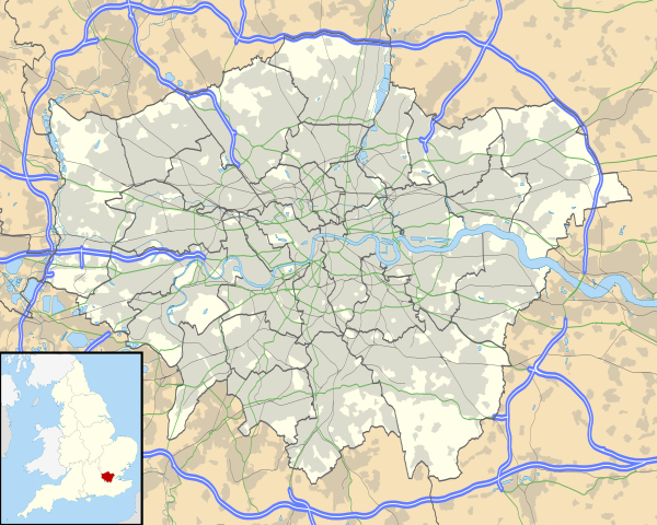
Map of Greater London, UK with the following information shown:
The data includes both primary routes and railway lines. Equirectangular map projection on WGS 84 datum, with N/S stretched 160% Geographic limits:
|
| ದಿನಾಂಕ | |
| ಆಕರ |
|
| ಕರ್ತೃ | Nilfanion, created using Ordnance Survey data |
| ಅನುಮತಿ (ಈ ಕಡತವನ್ನು ಮರುಬಳಕೆ ಮಾಡಲಾಗುತ್ತಿದೆ) |
ಈ ಕಡತ ಕ್ರಿಯೇಟಿವ್ ಕಾಮನ್ಸ್ Attribution
-Share Alike 3.0 Unported ಪರವಾನಗಿ ಹೊಂದಿದೆ. ವೈಶಿಷ್ಟ್ಯ: Contains Ordnance Survey data © Crown copyright and database right
|
| ಇತರೆ ಆವೃತ್ತಿಗಳು | File:Greater London UK district map (blank).svg - Blank map, File:Greater London UK location map.svg - excluding primary routes and railways |
.svg)
ಕಡತದ ಇತಿಹಾಸ
ದಿನ/ಕಾಲ ಒತ್ತಿದರೆ ಆ ಸಮಯದಲ್ಲಿ ಈ ಕಡತದ ವಸ್ತುಸ್ಥಿತಿ ತೋರುತ್ತದೆ.
| ದಿನ/ಕಾಲ | ಕಿರುನೋಟ | ಆಯಾಮಗಳು | ಬಳಕೆದಾರ | ಟಿಪ್ಪಣಿ | |
|---|---|---|---|---|---|
| ಪ್ರಸಕ್ತ | ೨೩:೧೩, ೫ ಅಕ್ಟೋಬರ್ ೨೦೧೦ | | ೧,೪೨೫ × ೧,೧೪೦ (೨.೧೮ MB) | Nilfanion | {{Information |Description=Map of Greater London, UK with the following information shown: *Administrative borders *Coastline, lakes and rivers *Roads and railways *Urban areas The data includes both primary routes and railway lines. |
ಕಡತ ಬಳಕೆ
ಈ ಕೆಳಗಿನ 2 ಪುಟಗಳು ಈ ಚಿತ್ರಕ್ಕೆ ಸಂಪರ್ಕ ಹೊಂದಿವೆ:
ಜಾಗತಿಕ ಕಡತ ಉಪಯೋಗ
ಈ ಕಡತವನ್ನು ಕೆಳಗಿನ ಬೇರೆ ವಿಕಿಗಳೂ ಉಪಯೋಗಿಸುತ್ತಿವೆ:
- af.wikipedia.org ಮೇಲೆ ಬಳಕೆ
- Londense Tower
- Westminster-abdy
- Twickenham
- Greenwich (Londen)
- Penge (Londen)
- Paleis van Westminster
- Canary Wharf
- St John's Wood
- Marylebone
- Stratford, Londen
- Queen Elizabeth Olympic Park
- Sjabloon:Liggingkaart Groter Londen
- Leyton
- Charing Cross
- Lughawe Londen-Heathrow
- Strand, Londen
- Muswell Hill
- London City-lughawe
- Dulwich Village
- Hampstead
- Silvertown
- Shoreditch
- Islington
- Clerkenwell
- Holland Park
- Soho
- Chelsea, Londen
- Southwark
- Hackney Central
- Notting Hill
- Paddington
- Crouch End
- Highgate
- Primrose Hill
- Bloomsbury
- Camden Town
- Spitalfields
- Vauxhall
- Holborn
- Kensington
- Battersea
- Belgravia
- Limehouse
- Bishopsgate
- ar.wikipedia.org ಮೇಲೆ ಬಳಕೆ
ಈ ಫೈಲ್ನ ಹೆಚ್ಚು ಜಾಗತಿಕ ಬಳಕೆಯನ್ನು ವೀಕ್ಷಿಸಿ.