
ಚಿತ್ರ:Ci-map.png
ಈ ಮುನ್ನೋಟ ಗಾತ್ರ:೨೭೬ × ೫೯೮ ಪಿಕ್ಸೆಲ್ಗಳು. ಇತರ ರೆಸಲ್ಯೂಶನ್ಗಳು: ೧೧೦ × ೨೪೦ ಪಿಕ್ಸೆಲ್ಗಳು | ೩೩೬ × ೭೨೮ ಪಿಕ್ಸೆಲ್ಗಳು.
ಮೂಲ ಕಡತ (೩೩೬ × ೭೨೮ ಚಿತ್ರಬಿಂದು, ಫೈಲಿನ ಗಾತ್ರ: ೨೪ KB, MIME ಪ್ರಕಾರ: image/png)
ಈ ಫೈಲು ವಿಕಿಮೀಡಿಯ ಕಾಮನ್ಸ್ನಲ್ಲಿ ಇರುವುದು. ಅಲ್ಲಿನ ವಿವರಣೆ ಪುಟವನ್ನೇ ಕೆಳಗೆ ತೋರಿಸಲಾಗಿದೆ. ಕಾಮನ್ಸ್ ಕೃತಿಸ್ವಾಮ್ಯತೆಯಿಂದ ಮುಕ್ತ ಫೈಲುಗಳ ಒಂದು ಆಗರ. ಅಲ್ಲಿ ನೀವೂ ಸಹಕರಿಸಬಹುದು. |
This image is in the public domain because it contains materials that originally came from the United States Central Intelligence Agency's World Factbook.
|
 |
via en:Image:Ci-map.png
ಕಡತದ ಇತಿಹಾಸ
ದಿನ/ಕಾಲ ಒತ್ತಿದರೆ ಆ ಸಮಯದಲ್ಲಿ ಈ ಕಡತದ ವಸ್ತುಸ್ಥಿತಿ ತೋರುತ್ತದೆ.
| ದಿನ/ಕಾಲ | ಕಿರುನೋಟ | ಆಯಾಮಗಳು | ಬಳಕೆದಾರ | ಟಿಪ್ಪಣಿ | |
|---|---|---|---|---|---|
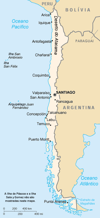
| ಪ್ರಸಕ್ತ | ೧೮:೨೨, ೭ ಫೆಬ್ರವರಿ ೨೦೦೬ | | ೩೩೬ × ೭೨೮ (೨೪ KB) | LeonardoG | This image was copied from wikipedia:pt. The original description was: Mapa do Chile. A tradução deste mapa para o português está lançada sob a GNU Free Documentation License. {{GFDL}} '''Fonte original''' * http:// |
| ೨೧:೪೭, ೨೨ ಜನವರಿ ೨೦೦೫ |  | ೩೨೫ × ೭೦೯ (೨೦ KB) | A-giâu | {{PD-USGov-CIA-WF}} via en:Image:Ci-map.png |
ಕಡತ ಬಳಕೆ
ಈ ಕೆಳಗಿನ ಪುಟವು ಈ ಚಿತ್ರಕ್ಕೆ ಸಂಪರ್ಕ ಹೊಂದಿದೆ:
ಜಾಗತಿಕ ಕಡತ ಉಪಯೋಗ
ಈ ಕಡತವನ್ನು ಕೆಳಗಿನ ಬೇರೆ ವಿಕಿಗಳೂ ಉಪಯೋಗಿಸುತ್ತಿವೆ:
- ast.wikipedia.org ಮೇಲೆ ಬಳಕೆ
- be-tarask.wikipedia.org ಮೇಲೆ ಬಳಕೆ
- ca.wikipedia.org ಮೇಲೆ ಬಳಕೆ
- cy.wikipedia.org ಮೇಲೆ ಬಳಕೆ
- da.wikipedia.org ಮೇಲೆ ಬಳಕೆ
- de.wikipedia.org ಮೇಲೆ ಬಳಕೆ
- de.wikibooks.org ಮೇಲೆ ಬಳಕೆ
- dsb.wikipedia.org ಮೇಲೆ ಬಳಕೆ
- en.wikibooks.org ಮೇಲೆ ಬಳಕೆ
- eo.wikipedia.org ಮೇಲೆ ಬಳಕೆ
- es.wikinews.org ಮೇಲೆ ಬಳಕೆ
- ff.wikipedia.org ಮೇಲೆ ಬಳಕೆ
- gl.wikipedia.org ಮೇಲೆ ಬಳಕೆ
- he.wikipedia.org ಮೇಲೆ ಬಳಕೆ
- he.wiktionary.org ಮೇಲೆ ಬಳಕೆ
- id.wikibooks.org ಮೇಲೆ ಬಳಕೆ
- io.wikipedia.org ಮೇಲೆ ಬಳಕೆ
- ja.wikipedia.org ಮೇಲೆ ಬಳಕೆ
- nn.wikipedia.org ಮೇಲೆ ಬಳಕೆ
- no.wikipedia.org ಮೇಲೆ ಬಳಕೆ
- pt.wikinews.org ಮೇಲೆ ಬಳಕೆ
- qu.wikipedia.org ಮೇಲೆ ಬಳಕೆ
- sa.wikipedia.org ಮೇಲೆ ಬಳಕೆ
- sv.wikipedia.org ಮೇಲೆ ಬಳಕೆ
- tl.wikipedia.org ಮೇಲೆ ಬಳಕೆ
- zh-min-nan.wikipedia.org ಮೇಲೆ ಬಳಕೆ